DATA MANAGEMENT & INSIGHTS
Capturing and managing high-quality raw geospatial data is important. However, turning that data into easy-to-interpret models and visualisations is what separates a surveying service from a real partner. SEAM Spatial’s expert analysis and reporting gives you a superior understanding of your project.
GIS AND SPATIAL DATA MANAGEMENT
RESOURCES | INFRASTRUCTURE | LAND DEVELOPMENT
Proper handling of your valuable spatial data – including terrestrial and aerial measurements, metadata, maps and plans – ensures that it’s always accurate, consistent and usable. SEAM Spatial manages your Geographic Information System (GIS) from end to end and delivers the information in the formats you need to make the right decisions.
With a focus on integrity and reliability, your data isn’t just secure. It’s ready to present in ways that are most practical and beneficial for your project.
")
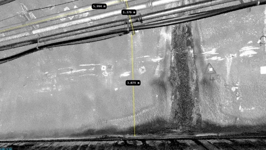
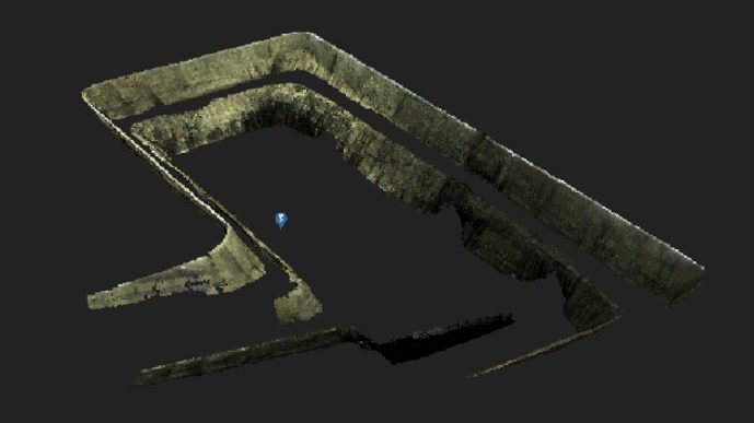
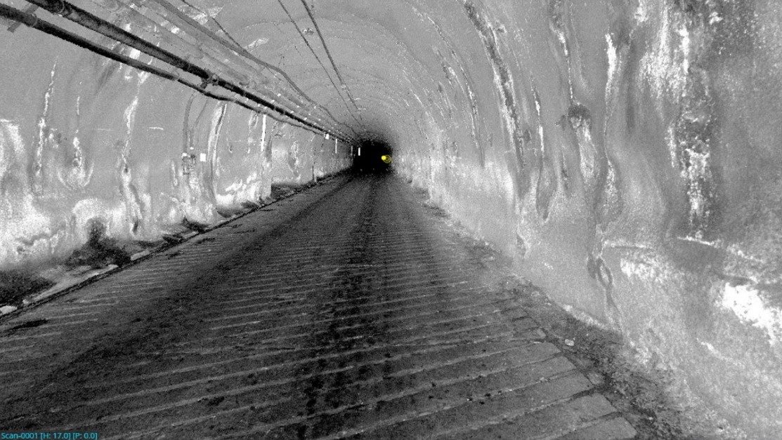
3D SCANS AND VISUALISATIONS
RESOURCES | INFRASTRUCTURE | LAND DEVELOPMENT

Based on accurate data from our advanced laser scanning and photogrammetry technology, SEAM Spatial transforms point clouds and orthorectified imagery into detailed 3D models and visualisations. These are ideal for simulating, studying and analysing complex structures and environments.
3D models provide a more immersive and interactive experience, offering insights that may not be visible or easy to understand in 2D representations.
BIM AND DIGITAL TWINS
RESOURCES | INFRASTRUCTURE
CAD and simple modelling may not be enough to provide you with the detail you need to get your project done right. For those situations, SEAM Spatial can combine our diverse capabilities, including Terrestrial and SLAM scanners and UAV. We’ll create highly advanced Building Information Modelling (BIM) with intelligent metadata and complete virtual replicas of your environment.
From concept to construction and beyond, get a holistic and dynamic view of your assets and optimise your operations.

SEAM TEAM INSIGHTS

No project has the same data and analysis requirements as another. That’s why the SEAM Spatial team works closely with you to determine the best formats to deliver your critical insights. Know everything you need to – without even stepping on-site.
TECHNOLOGY SUCCESS – POINTERRA
We were early adopters of drone technology and mobile laser scanning – and now we’re staying ahead with the world’s fastest end-to-end 3D data workflow and digital twin solution: Pointerra.